
Topographic survey
Field Survey + Drone Support
Field crews collect precise site data while drone imagery adds context for design, planning, and project review.
GEOMARX Land Surveying
Request topographic surveys, aerial imagery, boundary surveys, construction staking, certifications, lot splits, flood certificates, and other land survey services.
1
Choose services
2
Share address
3
Get next steps
What we do
These visuals show the kind of survey and mapping support clients request through GEOMARX Land Surveying.
From property lines and topographic data to aerial site imagery, the goal is simple: give you information you can use.
Field crews collect precise site data while drone imagery adds context for design, planning, and project review.
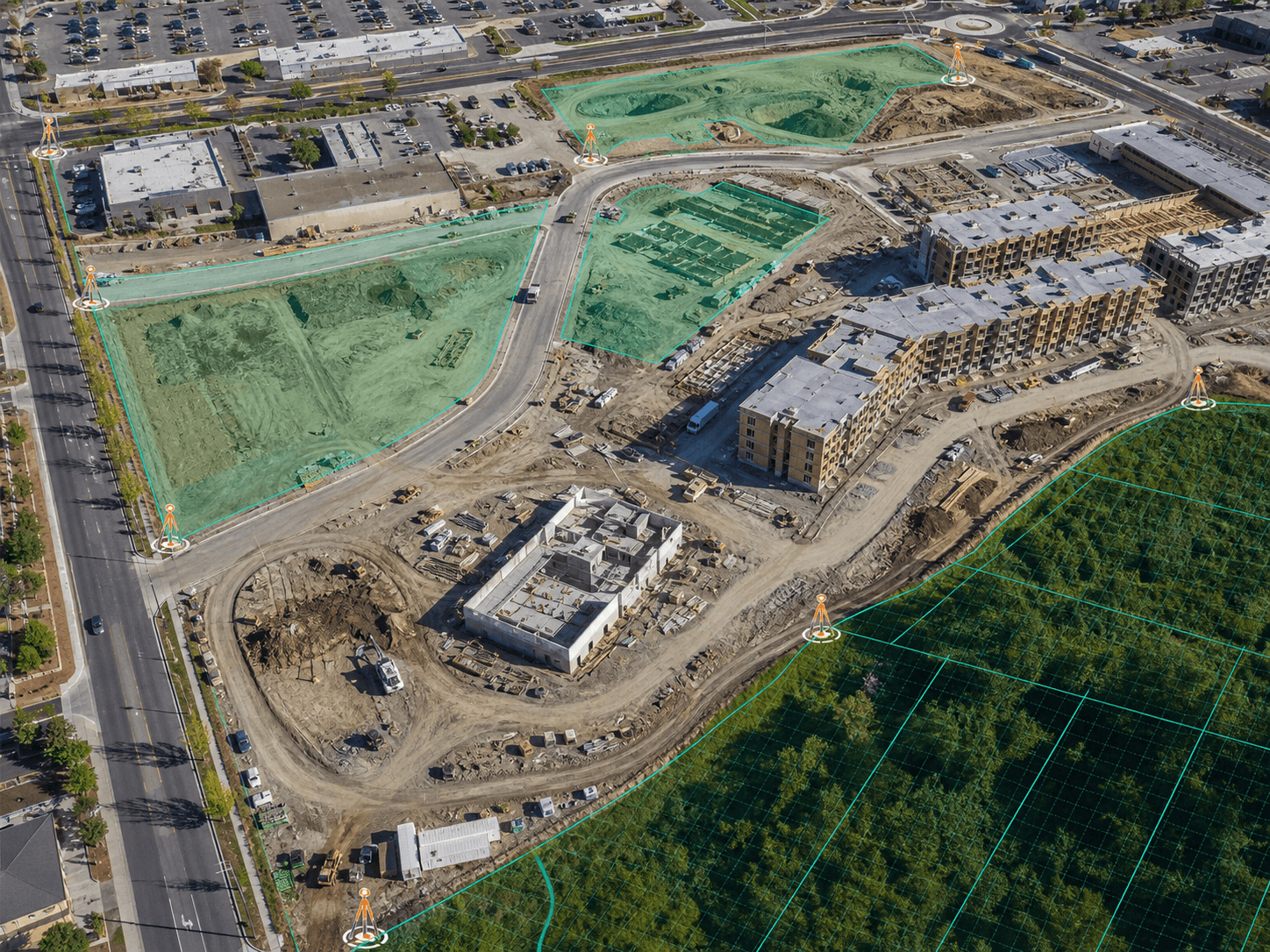
Drone mapping helps owners and builders understand large sites, construction progress, access, and property conditions.

Advanced visual documentation supports complex sites where clear records, measurements, and coordination matter.
Services
Pick one or more services in the form. If you are not sure, choose Other and explain what you are trying to do with the property.
Existing grades, contours, visible site features, utilities, and base mapping for design or permitting.
Drone imagery and site visuals for planning, progress documentation, and project coordination.
Property line research, field monument checks, boundary mapping, and practical site guidance.
Layout for buildings, utilities, grading, site improvements, and contractor field coordination.
Certification support for foundations, finished floor elevations, height checks, and permit milestones.
Survey support for lot splits, SB9 planning, parcel configuration, and agency submittal packages.
Elevation certificate and flood documentation support for owners, lenders, and insurance requests.
Not sure what to choose? Tell us the property address and what problem you need solved.
Process
The website is built around the request. No complicated language, no confusing paths, just the information needed to start a survey quote.
Step 1
Select one or more survey services from the request form.
Step 2
Send the address, APN if you have it, deadline, and what the survey is for.
Step 3
We review the request and respond with next steps, timing, and scope.
Before you request
Address, APN, or nearest cross streets.
Permit, fence, design, sale, insurance, or construction.
Email and phone so we can clarify details quickly.
Pick the service, share the address, and explain what you need. We turn that into a clear scope.
We help homeowners, builders, and developers understand which survey service fits the project.
Drawings, certificates, and staking work are prepared for the people who need to use them.
From a backyard addition to a construction site, the request flow stays straightforward.